A 1.8-acre parcel off Eel Point Road reads like room to spread out. Add the words "backed by conservation land" and it reads like room that will never shrink. Neither promise is quite true in Dionis, and the gap between what a listing says and what a survey actually allows is where more than one Nantucket closing has slowed down.
Dionis sells on privacy. The neighborhood sits on the north shore between town and Madaket, a quiet run of sandy lanes with no commercial development of its own, tucked behind some of the island's highest primary dunes. Much of what makes that privacy permanent isn't the size of any one lot. It's the fact that a large share of the land around those lots is protected forever, which sounds like pure upside until you start asking what "protected" does to the buildable footprint of the house next door to it.
The Rule That Doesn't Show Up in the Listing Photos
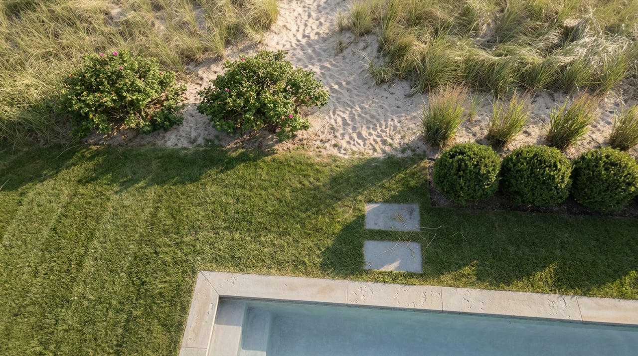
Nantucket's Conservation Commission enforces a wetlands bylaw that draws a hard line around any coastal bank, dune, beach, flat, marsh, or wetland on the island: no one may remove, fill, dredge, alter, or build within 100 feet of that resource area without a permit, and that 100-foot buffer applies whether the land in question is a public beach or a private backyard. In a neighborhood defined by dune frontage, that single rule does more to shape a parcel's usable footprint than the acreage figure on the listing sheet ever will.
This is the part that's easy to miss when a Dionis property is marketed by total acreage. A 1.8-acre lot with meaningful frontage on a dune or bank doesn't offer 1.8 acres of building envelope. It offers 1.8 acres minus whatever falls inside that 100-foot no-build zone, measured from the top of the bank or the landward edge of the dune, not from the property line. On a lot where the dune runs close to the house, that buffer can claim a real share of the parcel, often the exact share closest to the water view that justified the price in the first place.
What "Backed by Conservation Land" Actually Buys You
Some of Dionis's most desirable addresses sit against land held by the Linda Loring Nature Foundation, which manages 275 acres of sandplain grassland, pitch pine forest, and wetland along Eel Point Road. That acreage is protected from development by a conservation restriction held by the Nantucket Land Council, meaning it will remain in its natural condition permanently. No future owner, no future zoning change, no future buyer with deeper pockets can build on it.
For a homeowner, that's a real asset. It means the view and the quiet aren't at the mercy of the next subdivision. But it also means the boundary between a private lot and that conservation land is fixed in a different way than an ordinary property line. An empty lot next door might someday hold a house. Land under a permanent conservation restriction never will, which is good for privacy and irrelevant to the question of how much of your own acreage you can actually build on. A parcel advertised as bordering hundreds of acres of protected land is advertising a view and a buffer from future development, not extra square footage for your own foundation.
Here's the distinction that tends to surface only after an offer is in:
| What the listing tells you | What it doesn't tell you |
|---|---|
| Total lot acreage | Distance from the top of the bank or dune crest to the 100-foot no-build line |
| "Borders conservation land" | Whether that border is a permanent restriction or an undeveloped private lot that could still be built on later |
| Water view or dune frontage | Whether that view sits inside the protected buffer, limiting future additions or rebuilds in that direction |
| Days on market, price per acre | Whether the parcel already has a Conservation Commission Order of Conditions on file that narrows what can be built |
None of this shows up in a standard listing sheet. All of it shows up in a title search, a wetlands delineation, and a conversation with the Conservation Commission before an offer goes in, not after.
The Ground Itself Is Also Moving
The 100-foot buffer isn't measured from a line that stays put. The Town of Nantucket runs a Shoreline Change Monitoring Project with erosion stations at eight locations around the island, including one at Dionis Beach installed on August 26, 2022. By the time of that program's published monitoring update, the Dionis station had already recorded roughly a foot of bank loss since installation, a smaller number than the south shore's harder-hit stretches, but a real one.
That matters because the no-build buffer is measured from the top of the bank as it exists now, not as it existed when the house was built or when the last survey was filed. If the bank continues to retreat, the line that defines what's buildable moves with it, typically landward, typically shrinking the usable portion of the lot rather than expanding it. A buyer evaluating a Dionis property isn't just buying today's buildable footprint. They're buying a footprint that the coast itself has some say over.
Before You Write the Offer
None of this makes Dionis a harder place to buy than the rest of the island's west end. It makes it a place where the due diligence has to go a step past the listing sheet. Before an offer goes in on a dune-adjacent or conservation-abutting Dionis parcel, it's worth confirming:
- A current survey showing the top-of-bank or dune-crest line, not just the property boundary
- Whether a wetlands delineation has been filed with the Conservation Commission for that specific parcel
- Whether the abutting conservation land carries a permanent restriction, and who holds it
- Whether an existing Order of Conditions already limits construction, expansion, or septic work on the lot
- How that stretch of shoreline has trended in the Town's erosion monitoring data, where available
A buyer's attorney and a licensed surveyor are the right people to run these down. What a Dionis-focused agent can do is flag, before the offer stage, that the acreage on the listing and the acreage you'll actually be permitted to build on are two different numbers, and that the gap between them is exactly where this neighborhood's biggest selling point and its biggest planning constraint turn out to be the same piece of land.
FAQ
Does bordering conservation land help or hurt resale value in Dionis? It tends to help. Permanent protection from future development next door is part of what buyers are paying for in this neighborhood. The consideration isn't whether it helps value, it's whether it changes what you personally can build on your own side of that border.
Is the 100-foot setback the same for every Dionis property? The rule itself, no construction within 100 feet of a bank, dune, or wetland without a permit, applies island-wide under Nantucket's wetlands bylaw. Where that 100-foot line actually falls on a given lot depends entirely on where the top of the bank or dune sits on that specific parcel, which is why a site-specific survey matters more than the acreage figure.
Can a conservation restriction on neighboring land ever be reversed? Land held under a permanent conservation restriction, like the Linda Loring Nature Foundation's Eel Point Road property, is intended to remain undeveloped indefinitely. That permanence is the point, and it's part of why abutting a restricted parcel is treated differently from abutting an ordinary vacant lot.
Dionis rewards buyers who understand what they're actually protected by and what they're actually constrained by, often on the same piece of land. If you're weighing a dune-front or conservation-adjacent property here, or trying to work out what a specific parcel's real buildable envelope looks like before you make an offer, Sanford & Sanford can walk the lot with you and help you ask the right questions before you're under contract. Buy, Sell, or Rent with Sanford & Sanford.